Helicopters over Santa Clarita

Live helicopter tracking for Santa Clarita, Los Angeles County — updated every few seconds.

Area briefing

Checking the sky overhead…

GTLA AirWatch · Live area briefing · positions from ADS-B, rechecked every 20 seconds

Map of Santa Clarita, Los Angeles County
Scanning
Live map — checking for helicopters over Santa ClaritaThe dashed ring is the 3.5 km radius this page counts as “over Santa Clarita”; inner rings mark one-third and two-thirds of that distance.

Today over Santa Clarita

Nothing overhead now. The last helicopter left 33 minutes ago, heading northeast.

Verbs like “held over” and “circled” describe the recorded flight path, not what was happening on the ground. Nothing here states a crime, a fire or a casualty.

Who's hovering here?View the full live map

Recent incidents over Santa Clarita

The sky over Santa Clarita

415helicopter passes tracked over 65 days
44.7
passes per week
2.2
hours overhead per week
8 AM
busiest hour
Private
most common overhead

By hour of day

12a
3a
6a
9a
12p
3p
6p
9p
Busiest hour: 8a · this hour (2p) has averaged 25 passes historically

Who flies over Santa Clarita

  • Private43%
  • Sheriff23%
  • Fire / medical19%
  • News13%
  • Military2%
  • Other1%

The regulars over Santa Clarita

The aircraft recorded here most often — the ones you’ll see again.

Who flies over Santa Clarita, by the numbers

Private and charter helicopters over Santa Clarita

177 of 415 recorded passes over Santa Clarita were private and charter helicopters — 43% of the traffic here, 4.9 hours overhead in total.

Most often: LADWP (N704WP), 32 recorded passesusually 8am–11amtypically 1,850–2,600 ft

Private and charter aircraft are usually in transit, on a tour or a survey flight, and pass through without stopping.

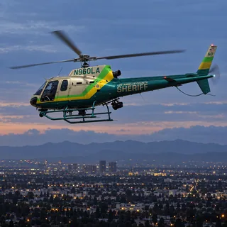
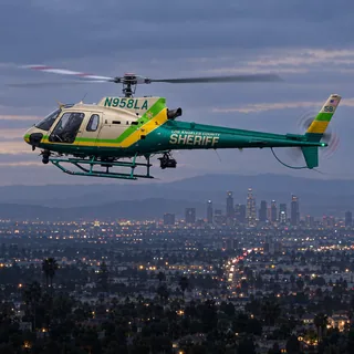
Sheriff's helicopters over Santa Clarita

95 of 415 recorded passes over Santa Clarita were sheriff's helicopters — 23% of the traffic here, 4 hours overhead in total.

Most often: LASD (N958LA), 22 recorded passesusually 8pm–11pmtypically 1,950–2,200 ft

Sheriff's aircraft fly patrol, search and rescue across the county, and orbit a scene the same way police aircraft do.

Fire and air-medical helicopters over Santa Clarita

79 of 415 recorded passes over Santa Clarita were fire and air-medical helicopters — 19% of the traffic here, 7.3 hours overhead in total.

Most often: LA Co FD (Helitanker) (N43CU), 7 recorded passestypically 1,850–2,900 ft

Fire and air-medical aircraft respond to fires, rescues and hospital transports — often brief, often low, and often straight in and out.

News helicopters over Santa Clarita

52 of 415 recorded passes over Santa Clarita were news helicopters — 13% of the traffic here, 3.8 hours overhead in total.

Most often: NewsChopper 4 (N358TV), 7 recorded passesusually 4pm–7pmtypically 2,100–2,550 ft

News helicopters hold a wider circle at a higher altitude and arrive after a story is already underway; several at once usually means something is being covered live.

What it usually means

Private / civil: Private and civil helicopters are usually in transit, on a charter, or on a survey flight.

Sheriff (LASD): Sheriff's helicopters typically orbit for a search, a pursuit, or to support deputies on the ground.

Fire / medical: Fire and air-medical helicopters mean a fire response, a rescue, or a hospital transport — often brief, and often at low altitude.

News helicopter: News helicopters usually mean live coverage of a developing story — a pursuit, a fire, or a scene the station is broadcasting.

Recent helicopter activity

Nearby coverage

All neighborhoods →

Helicopters over Santa Clarita common questions

Is that a sheriff's helicopter over Santa Clarita?

Sheriff's helicopters account for 23% of the 415 helicopter passes recorded over Santa Clarita. The one you see most is LASD (N958LA), 22 recorded passes. They are usually 8pm–11pm here. They typically fly at 1,950–2,200 ft above sea level. Sheriff's aircraft fly patrol, search and rescue across the county, and orbit a scene the same way police aircraft do.

Why is a fire helicopter over Santa Clarita?

Fire and air-medical helicopters account for 19% of the 415 helicopter passes recorded over Santa Clarita. The one you see most is LA Co FD (Helitanker) (N43CU), 7 recorded passes. They typically fly at 1,850–2,900 ft above sea level. Fire and air-medical aircraft respond to fires, rescues and hospital transports — often brief, often low, and often straight in and out.

Is that a news helicopter over Santa Clarita?

News helicopters account for 13% of the 415 helicopter passes recorded over Santa Clarita. The one you see most is NewsChopper 4 (N358TV), 7 recorded passes. They are usually 4pm–7pm here. They typically fly at 2,100–2,550 ft above sea level. News helicopters hold a wider circle at a higher altitude and arrive after a story is already underway; several at once usually means something is being covered live.

How high do helicopters fly over Santa Clarita?

From the passes recorded here: private and charter helicopters at 1,850–2,600 ft; sheriff's helicopters at 1,950–2,200 ft; fire and air-medical helicopters at 1,850–2,900 ft; news helicopters at 2,100–2,550 ft. These are the middle half of measured altitudes above sea level for each group, not a floor or a ceiling.

How long do helicopters stay over Santa Clarita?

Most passes are brief — a minute or two straight through. The aircraft that stay longest here are fire and air-medical helicopters: 7.3 hours overhead across 79 recorded passes. Fire and air-medical aircraft respond to fires, rescues and hospital transports — often brief, often low, and often straight in and out.

How can I tell if it's police or a news helicopter?

Police aircraft usually fly tight, repeated orbits over one spot and often stay for a long time. News helicopters tend to hold a wider circle at a higher altitude and arrive after an incident is already underway. This page labels each aircraft by its operator, so you don't have to guess.

Where does this data come from?

GTLA AirWatch tracks public ADS-B and MLAT broadcasts that aircraft transmit about their own position, the same open data used by air-traffic enthusiasts worldwide. It is updated every few seconds.

More from GTLA

Your way into GTLA.

From the aircraft overhead to the story on your block.