Tracking concluded
News Swarm — Major Fire Response
2 news helicopters standing off around Whittier — Major Fire Response.

Live helicopter tracking for Whittier, Los Angeles County — updated every few seconds.
Saved on this device. No account needed. Alerts are a separate choice.
Whittier, Los Angeles County
Checking the sky overhead…
GTLA Live · Live area briefing · positions from ADS-B, rechecked every 20 seconds
Saving the page and turning on alerts are separate choices. Choose alerts below, or keep a shortcut for your next visit.
Nothing overhead now. The last helicopter left 49 minutes ago, heading southwest.
Verbs like “held over” and “circled” describe the recorded flight path, not what was happening on the ground. Nothing here states a crime, a fire or a casualty.
The sky over Whittier
By hour of day
Who flies over Whittier
The aircraft recorded here most often — the ones you’ll see again.
Every aircraft our tracking has recorded here recently, most recent first. The named ones have a page of their own.
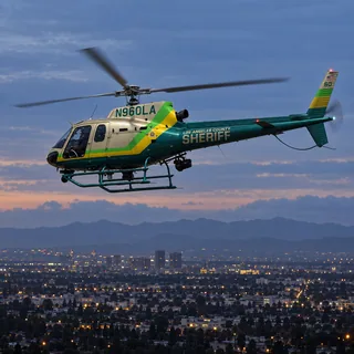
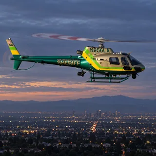
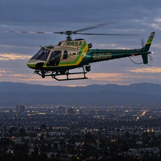
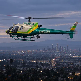
890 of 1,404 recorded passes over Whittier were sheriff's helicopters — 63% of the traffic here, 38.5 hours overhead in total.
Most often: LASD (N960LA), 44 recorded passestypically 850–1,150 ft
Sheriff's aircraft fly patrol, search and rescue across the county, and orbit a scene the same way police aircraft do.
319 of 1,404 recorded passes over Whittier were private and charter helicopters — 23% of the traffic here, 40.5 hours overhead in total.
Most often: Salmon River Helicopters (N155DB), 6 recorded passesusually 1pm–4pmtypically 950–1,700 ft
Private and charter aircraft are usually in transit, on a tour or a survey flight, and pass through without stopping.
60 of 1,404 recorded passes over Whittier were fire helicopters — 4% of the traffic here, 5.1 hours overhead in total.
Fire department aircraft respond to fires and rescues — often brief, often low, and often straight in and out.
58 of 1,404 recorded passes over Whittier were news helicopters — 4% of the traffic here, 1.5 hours overhead in total.
News helicopters hold a wider circle at a higher altitude and arrive after a story is already underway; several at once usually means something is being covered live.
What it usually means
Sheriff (LASD): Sheriff's helicopters typically orbit for a search, a pursuit, or to support deputies on the ground.
Private / civil: Private and civil helicopters are usually in transit, on a charter, or on a survey flight.
Fire / rescue: Fire helicopters mean a fire response or a rescue — often brief, and often at low altitude.
News helicopter: News helicopters usually mean live coverage of a developing story — a pursuit, a fire, or a scene the station is broadcasting.
Nearby coverage
Sheriff's helicopters account for 63% of the 1,404 helicopter passes recorded over Whittier. The one you see most is LASD (N960LA), 44 recorded passes. They typically fly at 850–1,150 ft above sea level. Sheriff's aircraft fly patrol, search and rescue across the county, and orbit a scene the same way police aircraft do.
Fire helicopters account for 4% of the 1,404 helicopter passes recorded over Whittier. Fire department aircraft respond to fires and rescues — often brief, often low, and often straight in and out.
News helicopters account for 4% of the 1,404 helicopter passes recorded over Whittier. News helicopters hold a wider circle at a higher altitude and arrive after a story is already underway; several at once usually means something is being covered live.
From the passes recorded here: sheriff's helicopters at 850–1,150 ft; private and charter helicopters at 950–1,700 ft. These are the middle half of measured altitudes above sea level for each group, not a floor or a ceiling.
Most passes are brief — a minute or two straight through. The aircraft that stay longest here are private and charter helicopters: 40.5 hours overhead across 319 recorded passes. Private and charter aircraft are usually in transit, on a tour or a survey flight, and pass through without stopping.
Police aircraft usually fly tight, repeated orbits over one spot and often stay for a long time. News helicopters tend to hold a wider circle at a higher altitude and arrive after an incident is already underway. This page labels each aircraft by its operator, so you don't have to guess.
GTLA Live tracks public ADS-B and MLAT broadcasts that aircraft transmit about their own position, the same open data used by air-traffic enthusiasts worldwide. It is updated every few seconds.
More from GTLA
From the aircraft overhead to the story on your block.
Follow real aircraft in 3D or 2D. See their identities, distinctive fleet liveries, flight trails, and the airspace around them—including temporary flight restrictions.
Launch AirWatch →Hear a helicopter? Find the aircraft near your location, see who operates it, and jump straight into tracking it on the map.
Identify an aircraft →Explore helicopter activity by neighborhood: what’s overhead now, recent visits, and the aircraft that keep coming back. Follow the places you care about.
Find your neighborhood →Revisit concluded scenes with 3D flight-track playback and archived station video when available. Open a Film Room replay from the Incident Desk’s briefing log.
Browse stories & replays →Bring local TV or radio alongside the live map. Follow the aircraft while you watch available station coverage, all inside AirWatch.
Open AirWatch · choose TV or Radio →Choose alerts for police chases and breaking scenes, or every news helicopter launch. Turn on the neighborhood you’re in with one tap, any other from its own page, and manage it all in one place.
Choose my alerts →