Nothing overhead now. The last helicopter left 21 minutes ago, heading southeast.
6:14pm — LASD (N956LA) passed through in 1 minute, low.came from Downtown(6:13pm) → went on to East LA(6:15pm)
6:08pm — LASD (N956LA) passed through in 1 minute, low.came from Bell(6:08pm) → went on to Little Tokyo(6:10pm)
5:48pm — Rogue Aviation (N335PD) passed through in 1 minute, mid-level.came from Chinatown(5:46pm) → went on to East LA(5:49pm)
5:43pm — Rogue Aviation (N335PD) passed through in 1 minute, mid-level.came from East LA(5:43pm) → went on to Chinatown(5:44pm)
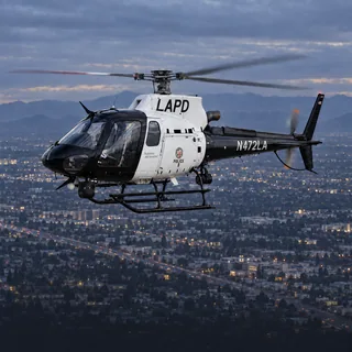
5:23pm — LAPD (N472LA) passed through in 3 minutes, low.came from Lincoln Heights(5:22pm) → went on to Downtown(5:26pm)
Verbs like “held over” and “circled” describe the recorded flight path, not what was happening on the ground. Nothing here states a crime, a fire or a casualty.
Who flies over Boyle Heights
Police47%
Sheriff19%
News18%
Private11%
Military2%
Other2%
Recorded flight patterns over Boyle Heights
Police helicopters over Boyle Heights
1,611 recorded passes by police helicopters over Boyle Heights, 94.7 hours overhead in total.
Most recorded overall: LAPD (N230LA), 143 recorded visitstypically 700–950 ft
Time and altitude patterns use the latest recorded passes, not the full history.
Police aircraft typically fly tight, repeated orbits over one spot to support officers on the ground, and can hold for a long time.
Sheriff's helicopters over Boyle Heights
638 recorded passes by sheriff's helicopters over Boyle Heights, 20.4 hours overhead in total.
Most recorded overall: LASD (N956LA), 92 recorded visitstypically 650–850 ft
Time and altitude patterns use the latest recorded passes, not the full history.
Sheriff's aircraft fly patrol, search and rescue across the county, and orbit a scene the same way police aircraft do.
News helicopters over Boyle Heights
617 recorded passes by news helicopters over Boyle Heights, 25.9 hours overhead in total.
Most recorded overall: SkyCAL / SkyFOX 11 (N39CL), 110 recorded visitsusually 3pm–6pmtypically 950–1,400 ft
Time and altitude patterns use the latest recorded passes, not the full history.
News helicopters hold a wider circle at a higher altitude and arrive after a story is already underway; several at once usually means something is being covered live.
Private and charter helicopters over Boyle Heights
379 recorded passes by private and charter helicopters over Boyle Heights, 7.7 hours overhead in total.
Most recorded overall: Mtm Aviation (N821MR), 28 recorded visitsusually 3pm–6pmtypically 900–1,200 ft
Time and altitude patterns use the latest recorded passes, not the full history.
Private and charter aircraft are usually in transit, on a tour or a survey flight, and pass through without stopping.
Possible pursuit: we tracked an AIR7 (N71HD) and an LASD helicopter (N958LA) flying 19 km in 17 minutes, the way police aviation flies a pursuit, ending here at 8:21pm. No agency has stated what it was. We are reading the flight pattern, not a dispatch.
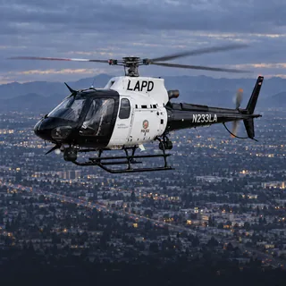
Possible pursuit: we tracked an LAPD helicopter (N233LA) and an LAPD helicopter (N267LA) flying 5 km in 3 minutes, the way police aviation flies a pursuit, ending here at 12:43pm. No agency has stated what it was. We are reading the flight pattern, not a dispatch.
Possible pursuit: we tracked an LAPD helicopter (N230LA) and an LAPD helicopter (N267LA) flying 35 km in 17 minutes, the way police aviation flies a pursuit, ending here at 11:13am. No agency has stated what it was. We are reading the flight pattern, not a dispatch.
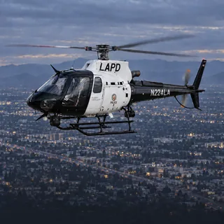
Possible pursuit: we tracked an LAPD helicopter (N224LA) and an LAPD helicopter (N232LA) flying 8 km in 5 minutes, the way police aviation flies a pursuit, ending here at 10:57am. No agency has stated what it was. We are reading the flight pattern, not a dispatch.
Possible pursuit: we tracked an LAPD helicopter (N224LA) and an LAPD helicopter (N230LA) flying 9 km in 5 minutes, the way police aviation flies a pursuit, ending here at 10:54am. No agency has stated what it was. We are reading the flight pattern, not a dispatch.
Police (LAPD / municipal): Police helicopters typically orbit for a search, a pursuit, or to support officers on the ground. A tight circle overhead usually means the activity is directly below.
Sheriff (LASD): Sheriff's helicopters typically orbit for a search, a pursuit, or to support deputies on the ground.
News helicopter: News helicopters usually mean live coverage of a developing story — a pursuit, a fire, or a scene the station is broadcasting.
Private / civil: Private and civil helicopters are usually in transit, on a charter, or on a survey flight.
Why is a police helicopter circling over Boyle Heights?
The live view identifies aircraft by operator. A flight path alone does not establish what happened on the ground. Police aircraft typically fly tight, repeated orbits over one spot to support officers on the ground, and can hold for a long time.
Is that a sheriff's helicopter over Boyle Heights?
The live view identifies aircraft by operator. A flight path alone does not establish what happened on the ground. Sheriff's aircraft fly patrol, search and rescue across the county, and orbit a scene the same way police aircraft do.
Is that a news helicopter over Boyle Heights?
The live view identifies aircraft by operator. A flight path alone does not establish what happened on the ground. News helicopters hold a wider circle at a higher altitude and arrive after a story is already underway; several at once usually means something is being covered live.
How high do helicopters fly over Boyle Heights?
From the passes recorded here: police helicopters at 700–950 ft; sheriff's helicopters at 650–850 ft; news helicopters at 950–1,400 ft; private and charter helicopters at 900–1,200 ft. These are the middle half of measured altitudes above sea level for each group, not a floor or a ceiling.
How long do helicopters stay over Boyle Heights?
Most passes are brief — a minute or two straight through. The aircraft that stay longest here are police helicopters: 94.7 hours overhead across 1,611 recorded passes. Police aircraft typically fly tight, repeated orbits over one spot to support officers on the ground, and can hold for a long time.
How can I tell if it's police or a news helicopter?
Police aircraft usually fly tight, repeated orbits over one spot and often stay for a long time. News helicopters tend to hold a wider circle at a higher altitude and arrive after an incident is already underway. This page labels each aircraft by its operator, so you don't have to guess.
Where does this data come from?
GTLA Live tracks public ADS-B and MLAT broadcasts that aircraft transmit about their own position, the same open data used by air-traffic enthusiasts worldwide. It is updated every few seconds.
More from GTLA
Your way into GTLA.
From the aircraft overhead to the story on your block.